Spatial data at the forefront of vaccination strategies in Zambia and Nigeria
Demand for accurate spatial data across sub-Saharan Africa is rising as governments formulate vaccination campaigns. In recent months, Zambia and Nigeria have requested support from GRID3 in creating and rolling out maps and spatial data technologies to aid these interventions. Continue reading to learn how GRID3 is responding.
Following the success of GRID3 maps for malaria microplans, the government of Zambia partnered with GRID3 again in April 2021 to use geospatial data to improve COVID-19 vaccination planning. The government plans to reach a total of 8.4 million people above the age of 18 (or a 70 percent vaccination rate) through mass campaigns. However, to date only 2 million doses of COVID vaccines have been administered. To increase vaccine uptake, the Expanded Programme on Immunisation (EPI) within Zambia’s Ministry of Health will be conducting more targeted vaccination campaigns. To prepare, EPI is developing microplans aimed at improving vaccine allocation planning and tracking vaccinations in all districts. (Microplanning refers to the process in which health workers document how to deploy resources—including vaccines and staff—to ensure that vulnerable populations are reached during a health intervention.)
In response, the GRID3 Zambia team produced 246 maps to support the EPI. The maps feature GRID3 data on population, settlements, and health facilities and will be integrated into the microplanning process alongside templates based on the WHO’s Reach Every District/Reach Every Child strategy. Standard operating procedures which describe how to use GRID3 maps for future COVID-19 vaccination microplans were also developed in collaboration with the Zambian government.
A GRID3 map of COVID-19 vaccination sites for Gwembe District in Zambia’s Southern Province.
After the maps were created, a national training of trainers (ToT) workshop was held from 15 to 17 November in Chongwe District. During the sessions, GRID3 Zambia presented on how to incorporate information from the maps into existing COVID-19 vaccination microplans. District-level workshops will be held in early 2022; the EPI officials trained in November will go on to train district health officials on how to fill in microplanning templates and utilise GRID3 maps.
EPI officials review GRID3 maps at ToT workshop in Chongwe District, Zambia.
Nigeria’s National Primary Health Care Development Agency (NPHCDA) has been leading the integration of spatial data into health service delivery. In early 2021, the agency collaborated with GRID3 and NASRDA to ensure the best available geospatial data are used to inform the country’s COVID-19 vaccine distribution strategy. During the same period, NPHCDA also requested technical support to develop a digital tool that provides insights into health service coverage during vaccinations.
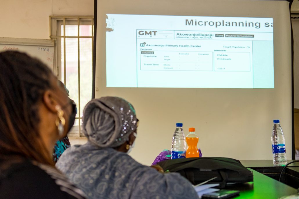
Working with Novel-T and NPHCDA, GRID3 Nigeria is creating a Geospatial Microplanning Toolkit (GMT), a web and mobile application that supports health officials in digitising microplans, delineating health facility catchment areas, estimating vulnerable populations, and planning vaccination interventions. Using a smartphone or tablet, officials can provide updates on the microplanning process, which enables live-tracking of campaign progress, coverage, and completeness at various administrative units. The GMT also allows data collection around missing settlements. Data are simultaneously entered into the main GRID3 Nigeria geodatabase.
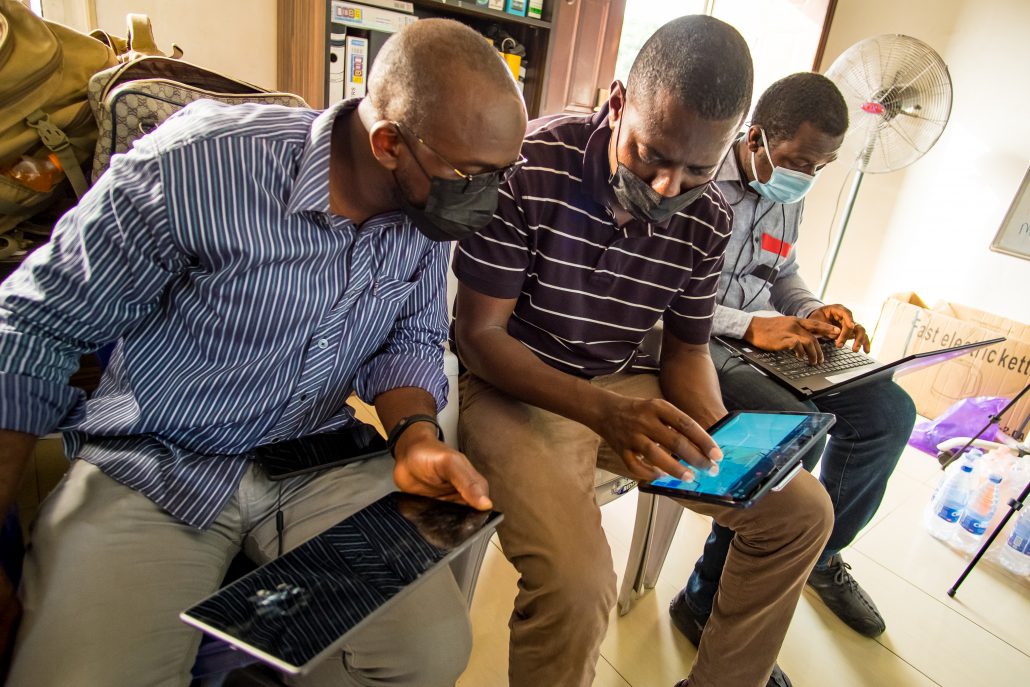
As part of the GMT development process, the toolkit was tested in 12 wards (the smallest administrative unit in Nigeria) in Kano and Lagos states during a week-long pilot led by NPHCDA in December 2021. Ward and health facility representatives were provided tablets and trained on how to use the application by NPHCDA. After the initial training, participants then simulated the microplanning process using the GMT. Feedback from this pilot is now being used to improve the toolkit’s features before a potential nationwide rollout in 2022.
In another effort to support the NPHCDA’s use of spatial data, the GRID3 team at Flowminder used its site placement optimisation algorithm to suggest the placement of new COVID-19 vaccination sites for all Nigerian states and local government areas. Using GRID3 data on population, settlements, and health facilities, the algorithm ranks each suggested site into three priority levels based on the target coverage to be achieved. A dashboard was produced to visualise the data outputs which has been delivered to NPHCDA. Thanks to these tools, the agency is able to better identify new priority sites for COVID-19 vaccination campaigns.
The ‘Optimisation for COVID-19 Mass Vaccination Campaign Sites’ dashboard
The use of geospatial data in Zambia and Nigeria highlights the shift towards data-driven decision making during times of crisis. GRID3 will continue to support countries’ efforts to use best-available spatial data and resources to power their development interventions.
