Zambian government works with GRID3 and partners to control malaria
In 2016, the World Health Organization (WHO) estimated 3 million people in Zambia had malaria. Within this population, 7% of these cases progressed to severe forms of the disease which, if left untreated, could be fatal especially for children under the age of 5 due to their lack of immunity. In a major effort to protect the Zambian population, the Government of the Republic of Zambia has set the ambitious goal to eliminate malaria by 2021. Currently, the Ministry of Health primarily relies on community-based surveillance and vector control measures. Zambia reached 84% of total coverage in 2018 through either insecticide-treated bed nets (ITN) or indoor residual spraying (IRS) interventions, a malaria intervention method that is preferred for settlements with 25 households or more. However, besides limited funding, the lack of up-to-date population and settlement data poses a constraint to understand the accuracy of reported coverage and to properly plan and execute interventions for nationwide malaria elimination.
GRID3 Zambia partnered with Akros and National Malaria Elimination Programme (NMEP) to create maps as a low-cost solution that can contribute significantly to control malaria in the country. The maps display GRID3 population estimates, settlement extents with estimated residential structure counts, schools, health facilities and village names. These datasets were developed with multiple Zambian government agencies including Zambia Statistics Agency (ZamStats), Office of the Surveyor General (OSG), Ministry of Water Development, Sanitation and Environmental Protection (MWDSEP), Ministry of Health (MoH), and Ministry of General Education (MoGE).
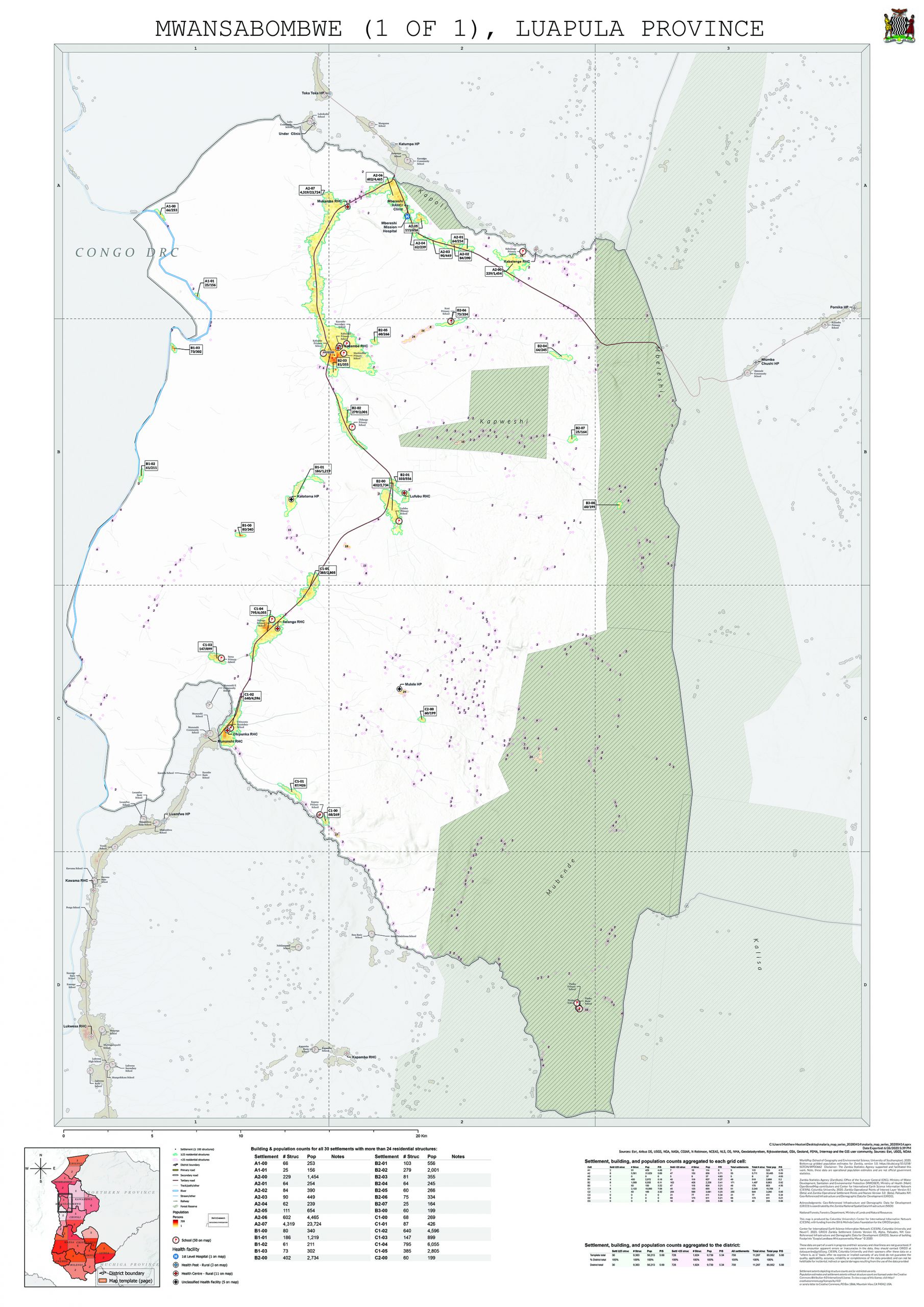
Example of a district planning map
“The maps play an important role in visualising villages that are in close proximity to each other and thus need to be sprayed in order to maximise the effects of IRS in protecting an entire community. This is different from the current approach where the distance to the next village is not shown. In addition, smaller more remote settlements have been put on a map for the first time. Some of these may have been missed in previous IRS/ITN interventions,”
details Silvia Renn, a GRID3 expert who worked on the project.
”Areas that were sprayed in past years will be marked on the maps by the district planners who are in charge of resource allocation. All areas that are not marked for spraying will be marked for net distribution. The information recorded on the maps will be used to guide insecticide and net allocation and distribution within the respective catchment areas.”
The mapping approach
In collaboration with ZamStats, the GRID3 Zambia team produced gridded population estimates that rely on household surveys to model population at 100 x 100m resolution. GRID3 also worked with various ministries to harmonise district and ward boundaries. Lastly, settlement extents were created using building footprints and point of interest data from various sources were compiled and standardised to provide recognisable landmarks or village names for settlement extents.
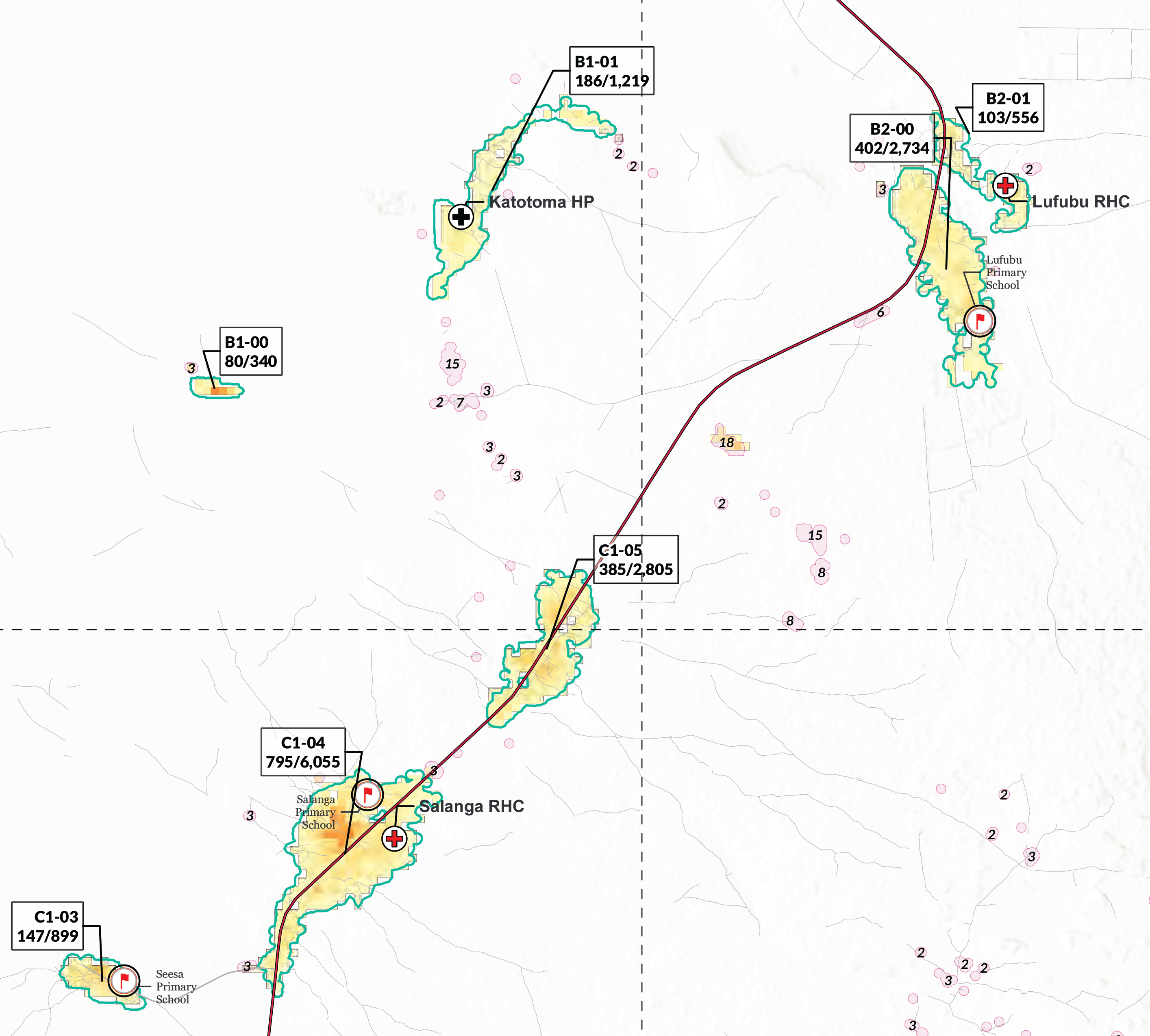
The district planning maps include settlement IDs, estimated residential structure counts and population, as well as points of interest. The pink polygons visualise the location of small hamlet areas and their estimated residential structure count.
The provision of settlement locations, population data and estimated residential structure counts will enable a more strategic approach to resource allocation for ITN and IRS coverage. This strategic approach is particularly important in the context of COVID-19 where national health systems may shift resources to cope with the pandemic, leaving other areas with deficiencies. While much remains unknown about the effects of COVID-19, previous or current malaria infection could expose affected populations to more severe outcomes.
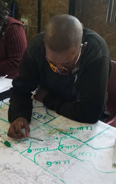
Operationalising the maps
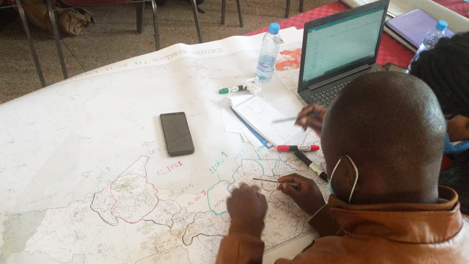
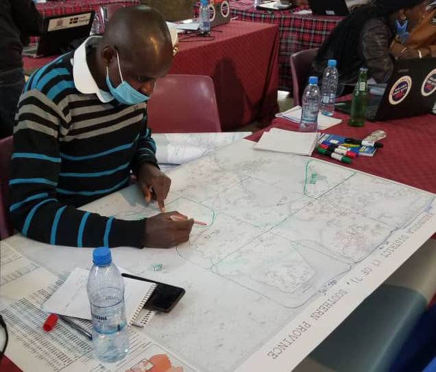
To ensure maps are finding their way into the hands of decision makers, Akros supported GRID3 Zambia and partners by developing a map template and training process around how to use them. These were then followed up with provincial microplanning training sessions for district stakeholders, funded by PATH, with the first pilots held in late June in Solwezi District, Copperbelt Province; Kasama District, Northern Province; and Mwansabombwe District, Luapula Province. Additionally, Akros presented at the GRID3 national-level Training of Trainers (TOT) in Lusaka and the provincial TOT in Kabwe. Akros’ support helped strengthen the capacity of national and provincial training teams to interpret and use the maps during microplanning.
In Gwembe District, Mike Mudenda, IRS manager for the region, commented on the process:
“To conduct planning using GRID3 maps was very helpful and gave us an opportunity to deal with real figures and structures on the ground. We were also able to visualise catchment areas and decide the best malaria control intervention in a particular area.”
In neighboring Mazabuka District, Richard Tembo, serving as the Malaria Elimination Officer also stated:
“The strategy used for training for mapping is so efficient. It helped to identify areas and made planning easy. Knowledge about eligibility of areas for IRS will widen.”
After very positive feedback, plans to scale up the process for 116 districts across all 10 provinces in Zambia are currently being implemented. The GRID3 Zambia team aims to support microplanning efforts by improving the availability of these maps, ensuring high intervention coverage as the country walks the last mile on the road to controlling malaria.
