New GRID3 Data Hub: 250+ datasets now openly available
When it comes to geospatial data, accessibility is just as crucial as quality. While it is important to produce comprehensive spatial information that is useful to GIS specialists whose work informs sustainable planning and decision making, equal attention must be paid to ensuring that such data is easily accessible for the wider community, such as development practitioners, researchers, and governments. With this in mind, GRID3 has launched its Data Hub.
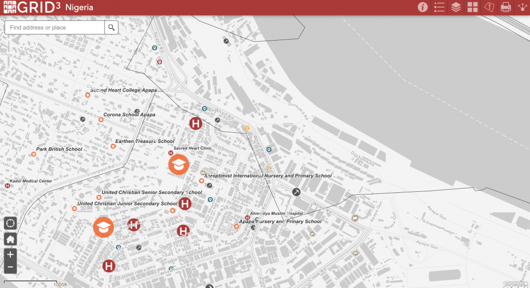
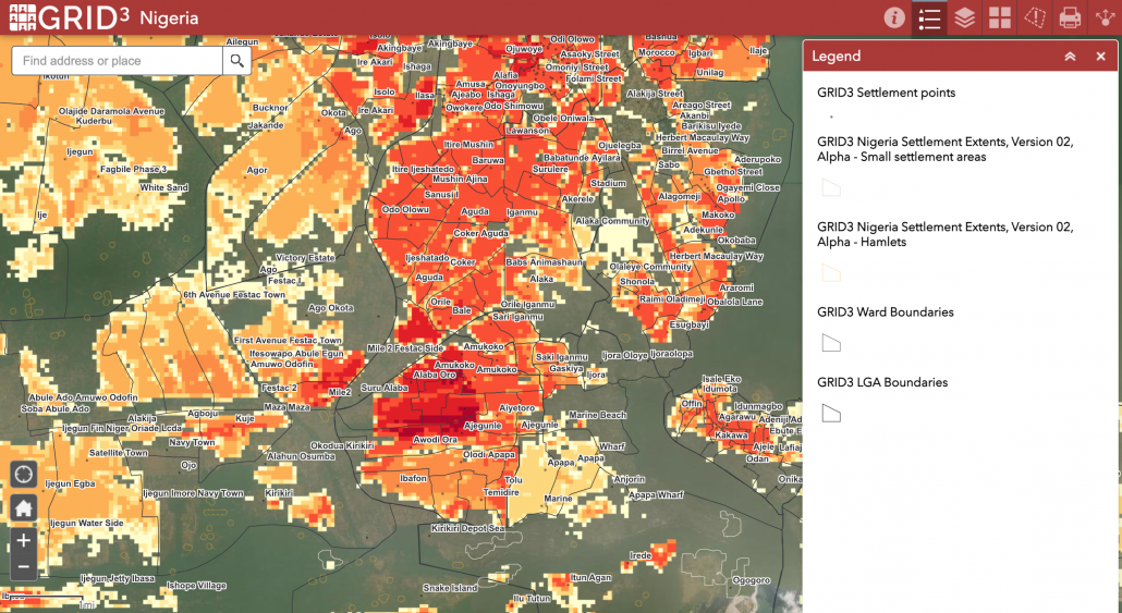
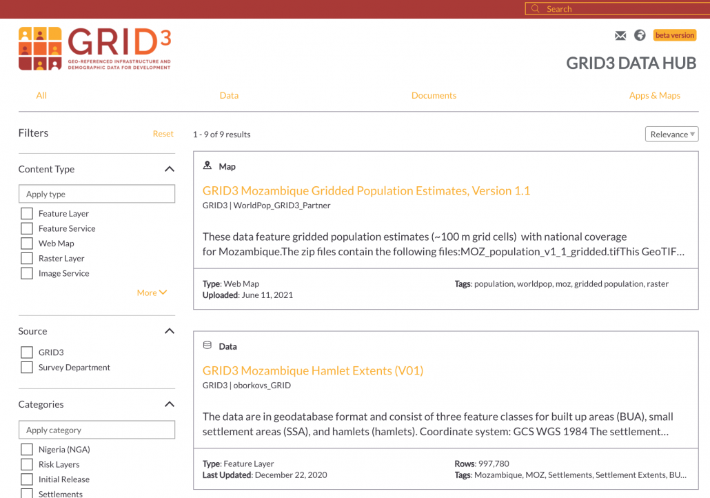
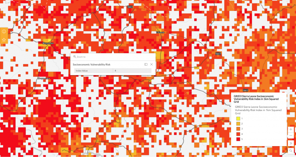
An online repository for GRID3 data, the hub’s contents can be used to inform development interventions ranging from COVID-19 vaccination campaigns to longer-term development projects such as filling service provision gaps. Currently, the hub hosts over 250 unique GRID3 datasets, including gridded population estimates for 6 countries, settlement extents (or the geographic areal coverage) for all of sub-Saharan Africa, as well as operational and administrative boundaries, risk analyses, points of interest, and physical distancing (also known as social distancing) data for multiple African countries.
“The Data Hub is a key step in helping partner countries disseminate GRID3 data across their government agencies, with international organisations, and among the wider geospatial community,” says Marc Levy, Director of GRID3. “With this platform, data can more easily reach those who need it the most.”
Facilitating data discovery and exploration
Utilising ArcGIS Online technology from Esri, the hub is a cloud-based, public-facing platform that can host a range of visualisation tools, including interactive web apps, dashboards, story maps, media, and surveys. It is designed to facilitate the easy discovery and exploration of GRID3 data without requiring GIS skills or specialised data visualisation software. Data are available in raster and vector formats and can be downloaded as geoJSON, shapefile, KML, and CSV files. Data can also be easily integrated with other datasets available on ArcGIS Online and Living Atlas to create interactive online maps and, more broadly, facilitate the use of GRID3 data in the ArcGIS online community.
The hub was developed to ensure a rich user experience; the interactive global map allows users to explore and visualise available data by data type or country. Users can preview data prior to downloading, filter the attributes for specific information (such as data for a certain administrative unit), and access data through an API, which allows users to access the most recent version. Through the data catalogue, users with an active ArcGIS Online account can add the data directly to their own maps and symbolise them as desired, while the “Data Summary” tool allows users to calculate and export (in CSV format) the number of key infrastructure within a certain radius of a specific location. For example, results from the tool can be used to perform an analysis that assesses distances between infrastructure locations; this, in turn, can inform development initiatives such as planning for health service delivery, siting of new school locations, or improved disaster response.
Building on previous collaborations
Early last year, GRID3 and Esri produced country-specific hubs for Namibia, Nigeria, Sierra Leone, and Zambia that were used to support those countries’ COVID-19 responses. Thanks to this collaboration, both were able to work closely and effectively on the development of the Data Hub, drawing on their respective fields of expertise. Lola Talabi-Oni, Technical Adviser for the Office of the Statistician-General at Nigeria’s National Bureau of Statistics, describes how the country’s COVID-19 data hub is making a difference:
“We were routinely asked to present analyses that inform the public about the COVID-19 crisis in Nigeria. The availability of the COVID-19 data hub has allowed us to take data from various sources and present this information in an easily accessible format. The in-depth visualisations on the hub ensure the public can view vital information on the number of cases, where the nearest health facilities are, and the most vulnerable populations.”
With the launch of the Data Hub, GRID3 data as well as country-specific data hubs are now consolidated into a single online platform. In the coming months, GRID3 and Esri will continue to collaborate on developing additional visualisation tools (such as interactive dashboards and story maps) that will further enhance the Data Hub’s interactivity.
