Geospatial data informs COVID-19 preparedness plans for migrant population in Zambia
Despite falling COVID-19 cases around the world, countries still need accurate information on people and resources to continue slowing the spread of the virus. In Zambia, the International Organization for Migration is using GRID3 data to mitigate the effects of the COVID-19 crisis on the country’s migrant population, which includes internally displaced persons, refugees, and migrant workers.
In Zambia, IOM is working to obtain accurate information on the numbers and locations of migrant communities in markets, refugee camps, and areas prone to flooding (locations that increase migrants’ susceptibility to health-related illnesses because they can be crowded and lack adequate sanitation and healthcare services) to ensure that migrants can withstand possible coronavirus outbreaks.
To support IOM’s efforts, Zambia’s Disaster Management and Mitigation Unit, GRID3 Zambia team, and Esri, developed an interactive web map to analyse how many people live within 30km of markets near the country’s borders and within 5km of refugee camps; the former distance helps to provide a picture of similar communities that tend to engage in commerce with one another, and the latter was used to determine populations’ access to important community services like health facilities and schools. Using GRID3 data on population (produced jointly with the Zambia Statistics Agency), settlements, district boundaries, and points of interest (markets, refugee camps, rivers, schools, and health facilities), the web map served as a tool to plan and implement COVID-19 response measures, such as building the capacity of local leaders to support migrants.
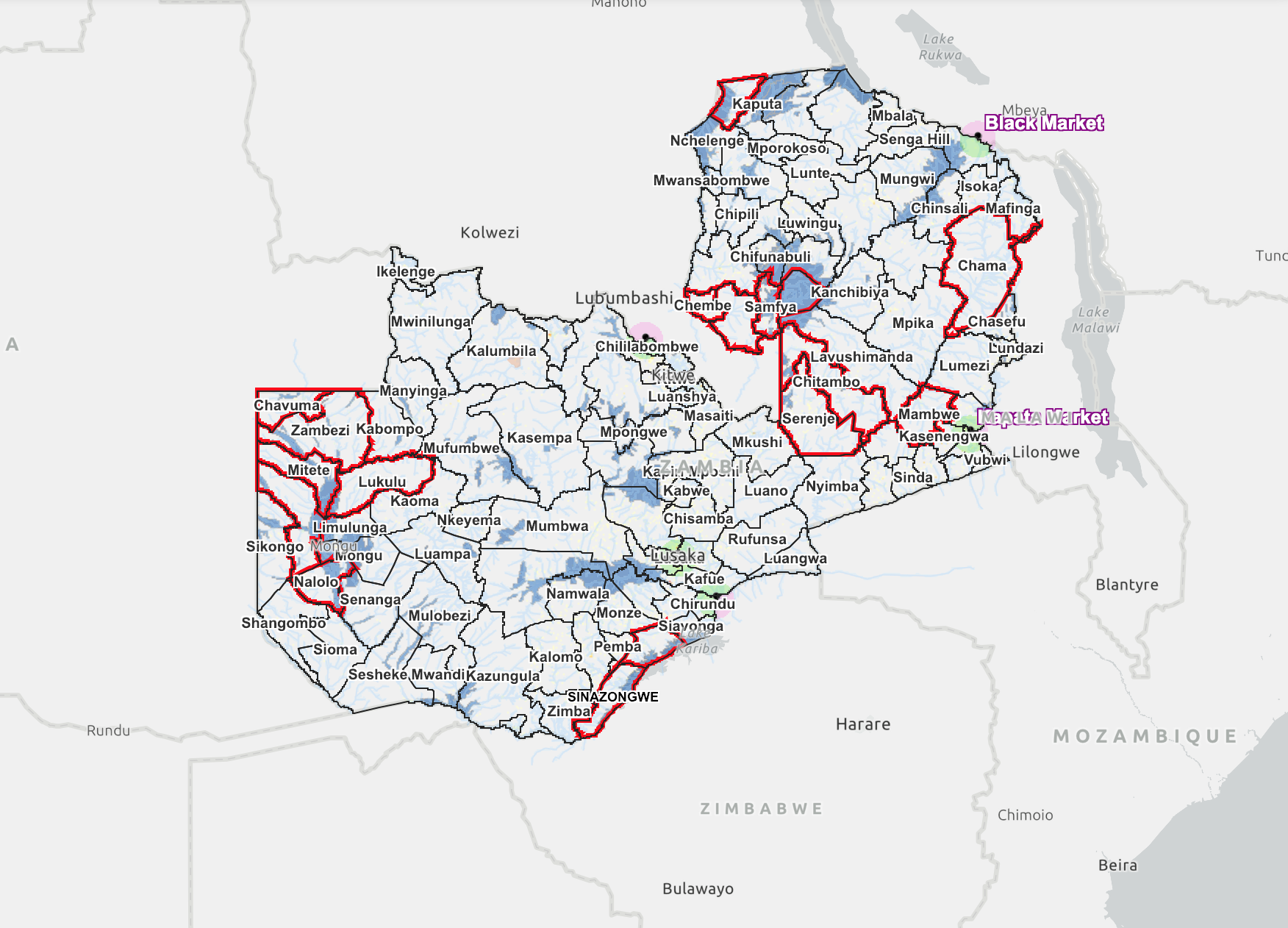
Web application featuring GRID3 data on population, settlements, district boundaries, and points of interest (markets, refugee camps, rivers, schools, and health facilities)
“Information from the web map was included in our National COVID-19 Preparedness Plan. This is the first time that population data were accurately aggregated to our required parameters. The data will help us plan for, and respond to, crises that may affect migrants that we support in Zambia,”
comments Nomagugu Ncube, Chief of Mission at IOM Zambia.
The GRID3 Zambia team will provide in-depth training on the web map to other relevant stakeholders to ensure the web map continues to aid planning efforts within the country. Additionally, GRID3 will be collaborating with IOM to produce similar data about other countries that have also experienced an influx of migrants as a result of globalisation and intense population movements.
