The Government of Zambia partners with GRID3 to produce high-resolution intercensal population estimates
GRID3 and the Government of Zambia have produced gridded population estimates, led by the Zambia Statistics Agency (ZamStats) to support the country’s humanitarian and development planning and operations across the country.
Gridded population data provide the Government of Zambia and public actors with recent and highly accurate estimates of their population across the country at very high resolution. Heather Chamberlain, one of the GRID3 experts working on the project, explains: “These data provide a detailed picture of where people live across the country, with estimates for roughly every 100x100m area. The level of detail in these estimates can really help the Government of Zambia to effectively plan and implement development interventions, as they provide insights into where the population is located, including information on the population size, age, and density at a very fine spatial resolution. In between censuses, this can help to ensure that all populations are considered in resource planning and allows for a more effective response to people’s needs.”
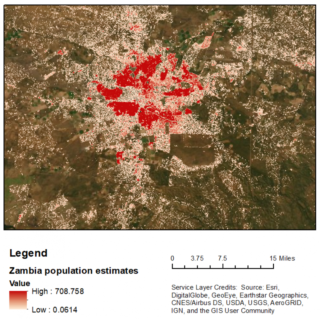
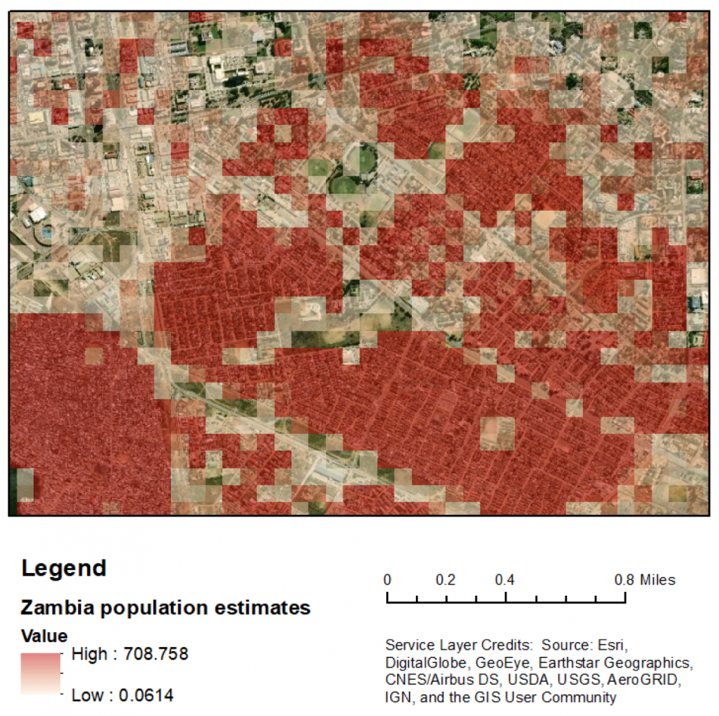
Please click on the maps for further details
Left map: Lusaka (capital city). Right map:: Zoomed in to the centre of Lusaka
While GRID3 and the Government of Zambia are urgently planning how these data can be integrated into the country’s response plan to the COVID-19 epidemic, GRID3 is regularly meeting online with different ministerial agencies to present the data and modelling approach, and determine which sectors would benefit from these estimates in the short, medium and long term. The team is working on utilising the estimates in malaria campaign planning, disaster management and pre-census fieldwork planning.
“GRID3 gridded population estimates are a key piece of the puzzle in supporting our country’s ambition of integrating geospatial data across all sectors of activity. Gridded population estimates will enable us to enhance the value of existing datasets through analysis such as streamlining health facilities catchment areas (regions where people can access health services), identifying facilities at risk of being over capacity or harmonising township boundaries. Without recent demographic data, plans and interventions might not necessarily be the most adequate” explains Mr Emmanuel Tembo, Project Manager at the National Spatial Data Infrastructure (NSDI) of Zambia.
Mr Frank Kakungu, Census Manager at ZamStats adds: “We’ve been working closely with the GRID3 team to strengthen our staff’s capacity in producing, maintaining and utilising geospatial data to support other government agencies in making the most of this data type. Our team has recently been trained on the bottom-up modelling and this is part of our long-term strategy to strengthen our national data system with comprehensive, recent and relevant geospatial information”.
How were the estimates produced: GRID3 Zambia model overview
GRID3 Zambia produced these gridded population estimates using a bottom-up modelling approach. For more information about the general method, please visit our high-resolution population estimates page. Innovations of the GRID3 Zambia model include the use of new settlement data sources and the fact that the population input data was solely collected by the Government of Zambia. Claire Dooley, GRID3 Lead Modeller for Zambia explains:
“Previous GRID3 models, such as Nigeria or the Democratic Republic of the Congo, have utilised microcensus survey data that were collected specifically for the purpose of population modelling. Because ZamStats had collected survey data recently and had used advanced location recording techniques, we were able to use the survey population counts for the population modelling. Being able to use existing field collected data for this purpose meant that no extra fieldwork was needed to carry out the population modelling work. With these data, taken from the Saving Mothers, Giving Life survey (2017), the Livestock Census survey (2018), and the pre-census enumeration survey (2019), we were given a recent and comprehensive overview of the population for sample locations, which served as a robust foundation for the model. In addition, we used recent building footprint data extracted from Ecopia Landbase Africa and powered by Maxar.”
“The data provided very accurate high-resolution details on settlements, and their unique characteristics, across the country. It’s worth noting that despite the accuracy of the data used as an input to our model, our gridded data still remain estimates and do not provide 100% accurate counts of the population nationally. Therefore, integrating confidence intervals into decision making provides useful predictions for certain interventions.”
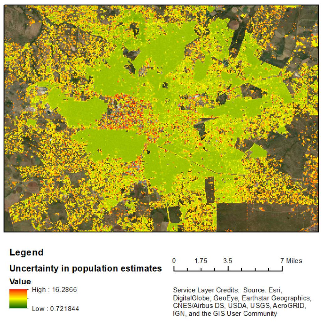
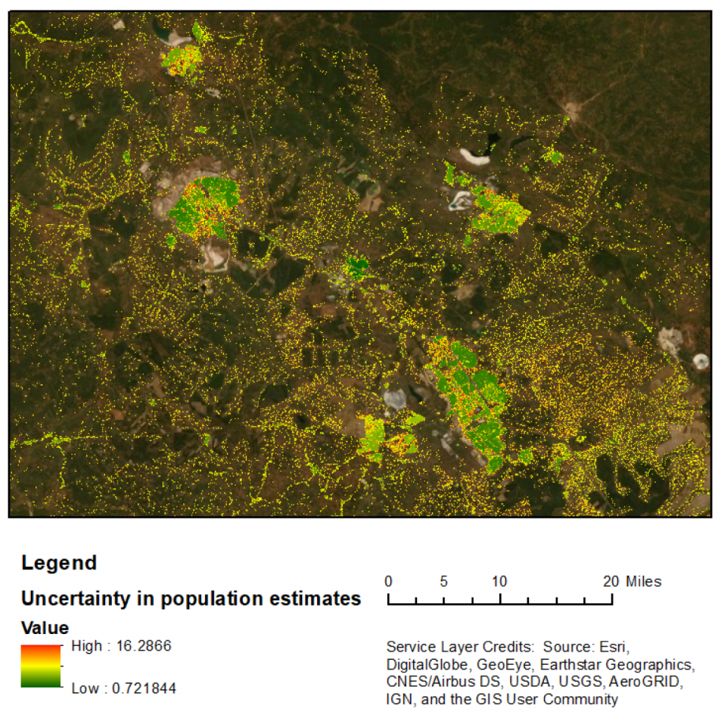
Please click on the maps for further details
Left map: Lusaka. Right map: Urban centres in Copperbelt province (Ndola, Kitwe and Chingola)
Where to access the data?
GRID3 Zambia gridded population estimates are available here. Data includes raster files and access to an online interface, where users can interact with an app to, for example, retrieve population estimates (and their associated uncertainty measures) within user-defined geographic areas or get estimates of population sizes for specific demographic groups.
For enquiries about the data, please contact us.
