Sierra Leone tackles HPV in its latest nationwide vaccination campaign
Cervical cancer is the second most common cause of cancer deaths for women in Sierra Leone, according to government figures. With the sexually transmitted Human Papillomavirus (HPV) the leading cause of cervical cancer, it’s a matter of urgency to vaccinate young people for HPV before they become sexually active.
To that end, Sierra Leone’s Ministry of Health and Sanitation and its Expanded Programme on Immunization (EPI) embarked on a campaign with Clinton Health Access Initiative (CHAI), Gavi, GRID3, and WHO to administer vaccines to 153,991 ten-year-old girls throughout the country (the number is the projected population figure for that age group in the country, according to Sierra Leone’s national statistics office). Throughout 2022, GRID3 has served as a key technical partner in the campaign, developing 223 microplanning maps to support campaign planning.
Source: CHAI
Devising the maps
In 2021, the government and GRID3 were working to use GRID3 data in the country’s COVID-19 vaccination outreach when it was decided that these data could also be used to improve outreach for the upcoming HPV campaign, as well as for campaigns geared towards reaching children missed during earlier routine immunisation campaigns. The ministry and EPI asked GRID3 to create a set of multi-purpose maps that could estimate the right denominator (i.e. how many people need vaccines) and locate the target group (i.e. where those people who need vaccines live) for each campaign.
The HPV campaign targeted two groups of 10-year-old girls: those currently enrolled in school and those who are out of school. School teachers identified eligible students in the former population while community health workers identified eligible girls in the latter.
In prior vaccination campaigns, Sierra Leone had been using hand-drawn maps of the country’s districts. GRID3’s new multipurpose maps would be geospatially based; using GRID3 data on population (broken down by age and sex groups), settlements, and school data from the Ministry for Basic and Senior Secondary Education (MBSSE), the maps are a significant improvement over the hand-drawn maps. The maps were produced much faster, are more accurate, facilitate the calculation of distances between settlements, and can be used to identify hard-to-reach areas. These advantages help to improve the microplanning that takes place in advance of vaccination outreach (microplanning is the process health workers use to optimally deploy resources, including vaccines and personnel, to ensure that vulnerable populations are reached during health campaigns).
In total, 223 maps were produced (16 district-level, 190 chiefdom-level, and 17 township level). In addition to information relating to populations in need of HPV, COVID-19, and RI vaccine doses, the maps also contain data on health facility locations, schools, and sites that can be served by mobile vaccination teams. Additionally, the maps show travel times to nearest health facilities; settlement names, points, and extents; and health facility catchment area boundaries.
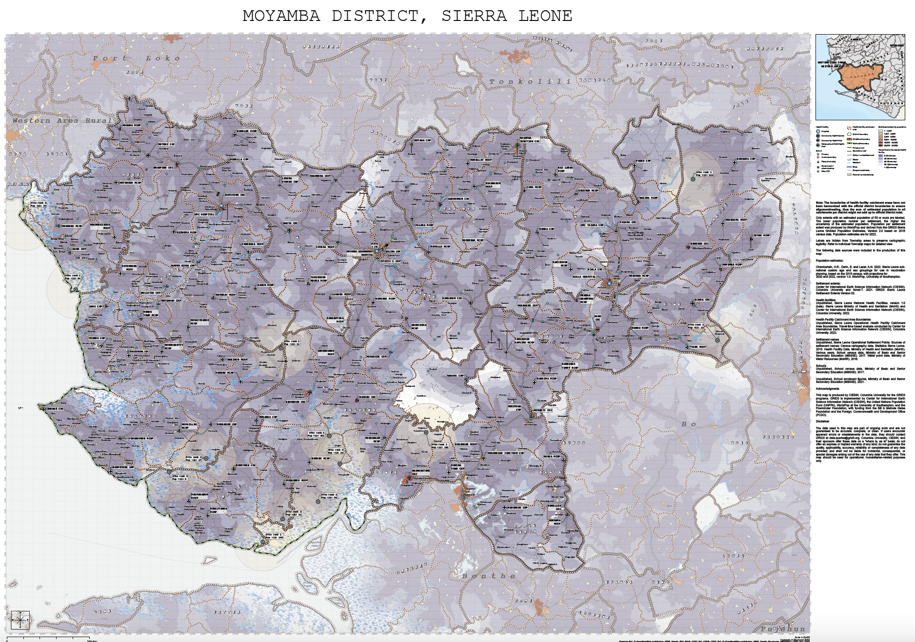
Example of a map produced by GRID3
Validating data and building skills
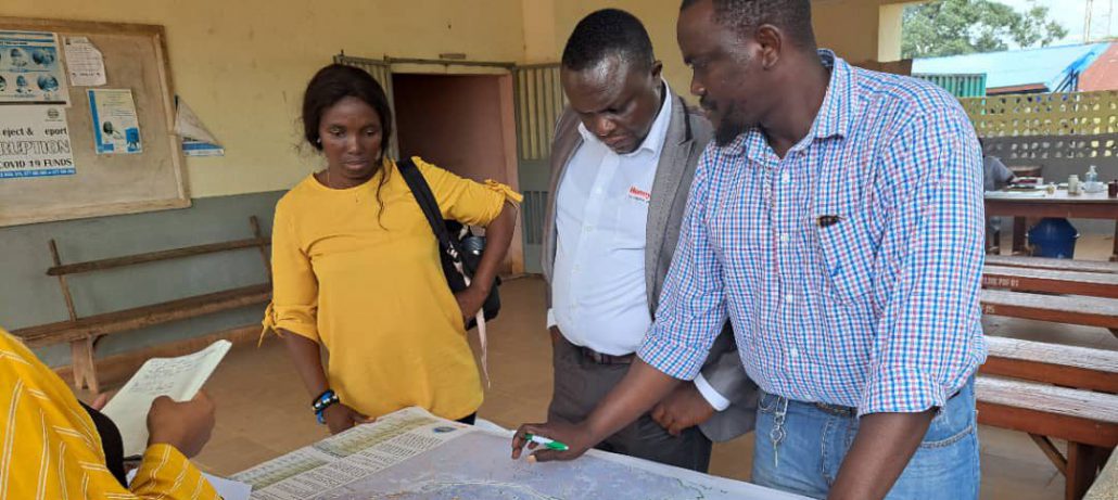
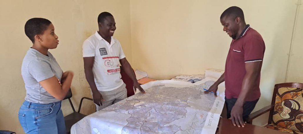
GRID3 and government partners hosted a microplanning workshop in May 2022 to validate the microplanning strategy and train partners in the use and advantages of GRID3 microplanning maps. Participants included Ministry of Health and Sanitation’s district medical officers, monitoring and evaluation officers, and MBSSE district education officers.
In September 2022, CHAI printed and distributed the maps for specific districts, chiefdoms, and towns. GRID3 then participated in a second workshop in September and gave a presentation on how to use its maps.
Overall, the HPV campaign was highly successful; it took place from 3 October to 11 October and 177,141 vaccines were administered across 16 districts.
“The GRID3 microplanning maps were very useful. They helped us identify health facilities that were hard-to-reach and those in riverine areas in our district,”
says Emil Fillie, District M&E Officer, Falaba District.
Much work remains to be done. Health officials can be more effectively trained in using the maps, while the maps themselves can be more widely distributed and more commonly used. GRID3 will work toward these goals, as well as continue to provide other forms of assistance, including co-producing a master health facility list (alongside MoH’s Directorate of Policy, Planning and Information) and updating GRID3 maps with newly available population data.
