Population estimates in the Democratic Republic of the Congo draw on one of the largest survey efforts in almost 40 years
This January saw the release of new population estimates for seven provinces in eastern Democratic Republic of the Congo (DRC): Haut-Katanga, Haut-Lomami, Ituri, Kasaï, Kasaï-Oriental, Lomami, and Sud-Kivu. The estimates draw on several pieces of key input data, including the results of a microcensus survey conducted by the GRID3 Mapping for Health project in March-April 2021 (one of the country’s most extensive surveys of demographic information since the 1984 national census).
The estimates are an important step forward in DRC’s efforts to use accurate, up-to-date population data that can allow policymakers to improve access to health services, particularly immunisation.
Creating a solid demographic picture
A microcensus contains less-detailed questions and covers a smaller number of households than in a full national census. The data obtained from these interviews are combined with data from high-resolution satellite imagery into a statistical model that uses a ‘bottom-up’ approach to estimate population numbers in unsampled areas. A microcensus is a fast way to obtain a solid demographic picture that has the added virtue of being significantly cheaper than a national census. In the DRC, the microcensus effort was led by the GRID3 Mapping for Health team at Flowminder. GRID3’s WorldPop team contributed to the survey sampling and provided technical expertise to support implementation; the Kinshasa School of Public Health led the fieldwork; and the Institut National de la Statistique (INS) (via the Bureau Central de Recensement, BCR) provided the necessary authorisation and oversight.
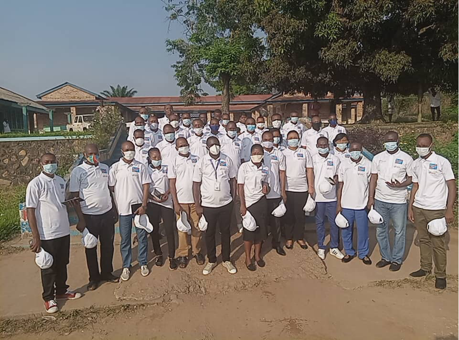
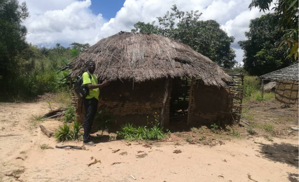
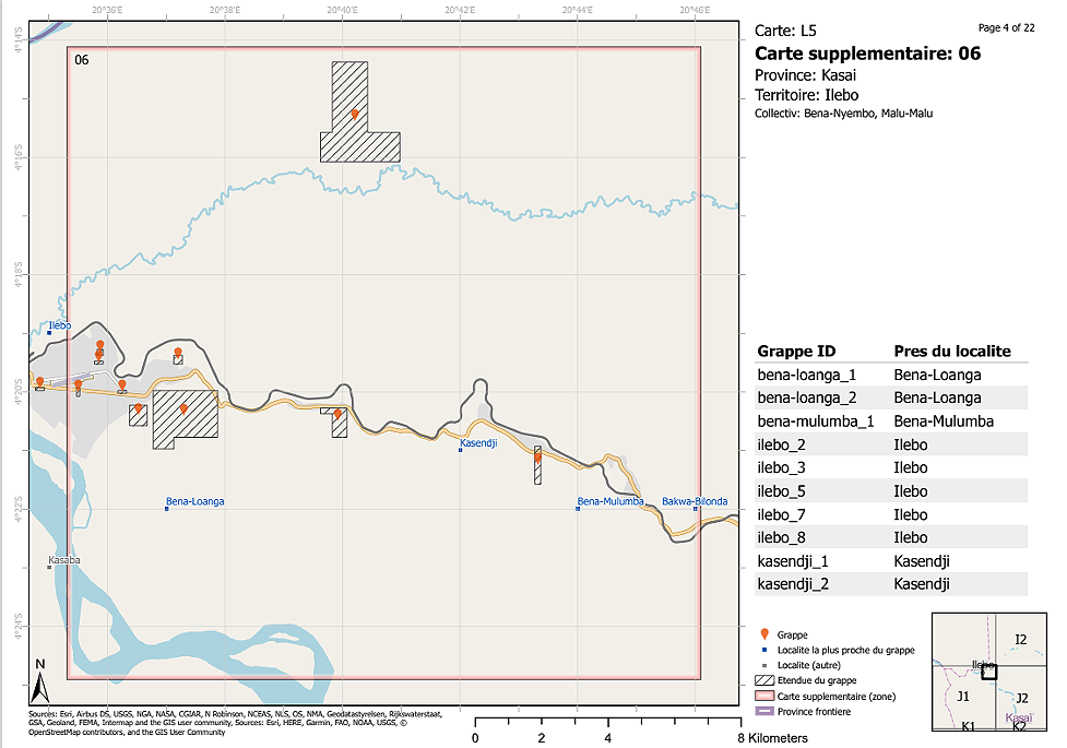
In advance of enumeration, the partners sampled a number of survey sites and created digital and analogue maps that would enable field teams to navigate to select field locations. These maps showed the locations of the survey clusters in relation to settlements and displayed building footprints for each survey cluster (to aid identification of the locations to be surveyed). KSPH trained the 210 enumerators and 35 supervisors who comprised the field teams. Following two pre-tests conducted to discover and troubleshoot challenges that might arise, enumerators began data collection. By the end of the 46-day enumeration period, the teams had covered 1,497 out of the 1,596 identified clusters, or 94 percent (substantially above the target of 80 percent). The remaining clusters were not reached due to insecurity or other challenges such as geographic inaccessibility and the misidentification of settlements in satellite imagery.
The microcensus’s success was possible thanks to several factors, including the professionalism of the fieldwork staff and real-time communication across the teams that allowed coordinators to report on their progress and overcome obstacles (such as inaccessible enumeration areas). Crucial to the exercise’s outcome was that the fieldwork teams were made of local enumerators who had knowledge about local contexts and spoke the dialects used in their respective areas.
These microcensus data were used by the GRID3 team at WorldPop to create the population estimates that use the bottom-up method. In addition, these data (cleaned after a months-long effort) will be handed over to the BCR for archiving.
Putting the estimates to use
The final high-resolution population estimates have been shared with DRC health authorities (as well as other key national actors and international development partners) to ensure that they inform decision-making across a range of sectors. The estimates are being used as part of a new methodology of georeferenced documentation to support microplanning that provide a more up-to-date population denominator. With better data, health planners can improve planning for routine immunisation, thus reaching more children with essential vaccines. As the population estimates are publicly available, they can be freely used in planning various development interventions, as well as provide an important input for additional development indicators.
The population estimates can be found through the GRID3 Data Hub.
GRID3 Mapping for Health in the Democratic Republic of the Congo is a Ministry of Health initiative, supported by Gavi through its INFUSE programme and implemented by Flowminder and the Center for International Earth Science Information Network at Columbia University. The project is a continuation of previous work supported in DRC by GRID3.
