Planners in Zambia continue to draw on geospatial solutions to make sure no one is left behind
One of GRID3’s programmatic goals is to strengthen countries’ capacities to use geospatial data and technologies for development interventions. In May 2022, GRID3 delivered an extensive training of trainers (ToT) programme in Zambia which was attended by urban and rural planners from 10 provinces. This programme is a follow-up to QGIS beginner and intermediate trainings conducted in 2021. As a result of these trainings, planning councils look to use geospatial solutions to inform integrated development plans (IDPs). Such plans highlight key development challenges within an area and detail how planners will address these challenges within a specified time frame and in accordance with national planning standards. Accurate geospatial data and GIS technology can support planning officials in understanding where service gaps exist.
Behind the ToT programme
After learning about a strong need for technical capacity strengthening in the Department of Physical Planning (under Zambia’s Ministry of Local Government and Rural Development), GRID3 delivered two geographic information systems (GIS) trainings to members of the department in April and May 2021. Topics covered included introduction to QGIS, understanding coordinate reference systems, spatial data management, creating and editing GIS data, use of GRID3 data for IDPs, and basic map production.
At the concluding session, participants expressed interest in extending the training to include more planning officers. In response, GRID3 prepared a virtual ToT programme for May 2022, in which planners from all of Zambia’s 10 provinces were provided training and resources in teaching and presenting GIS-related information. Topics covered included population and other data sources, data visualisation, making thematic maps using customised styles and map templates, geoprocessing and spatial analysis, using GIS for IDP gap and poverty analysis, access to healthcare gaps analysis, remote sensing and change analysis, deforestation analysis, multi-criteria, and new school placement. Following the completion of the programme, trainees have been conducting their own training sessions in which they train other professionals in the planning community. To see the GRID3 training catalogue with general course descriptions, please visit the Learning Management System.
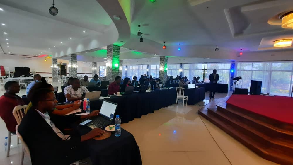
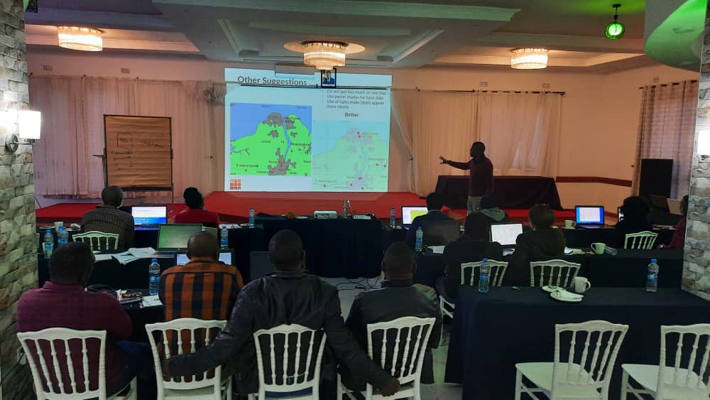
ToT programme facilitated by Ministry of Local Government graduates of the May 2022 ToT programme in Luapula province, July 2022
Skills and data in action
Based on feedback gathered from ToT programme participants, districts are planning to use GRID3 geospatial data (settlements, schools, health facilities, and population estimates) and GIS technology to inform their IDPs.
“[The skills from this training] will be used to formulate and analyse spatial data in order to have a clear idea of what Chienge District needs in terms of resolving developmental issues and implementing activities for economic growth and poverty reduction.”
Marriam Chimpombe, Assistant Town Planner, Chienge District
“The training is proving to be very useful in the preparation of integrated development plans…For my district, we do not have a lot of data to help analyze the current nature of development. Through this training, however, I now know where to find the data I need and have the necessary skills to perform specific analyzes.”
Joshua Kamkompe, Luapula Province
“The training comes at a much-needed time. There are two districts that are still preparing integrated development plans in my province and they are at the stage where they are collecting social-economic and spatial data. It therefore puts me in a position to assist them with data collection and analysis.”
Chipo Chongo, Department of Physical Planning, Southern Province
In particular, three districts, Luapula, Shiwangandu, and Serenje, are using the maps they produced in the ToT programme sessions to support their regional planning efforts. The maps demonstrate service gaps and the spatial distribution of people and key infrastructure such as schools.
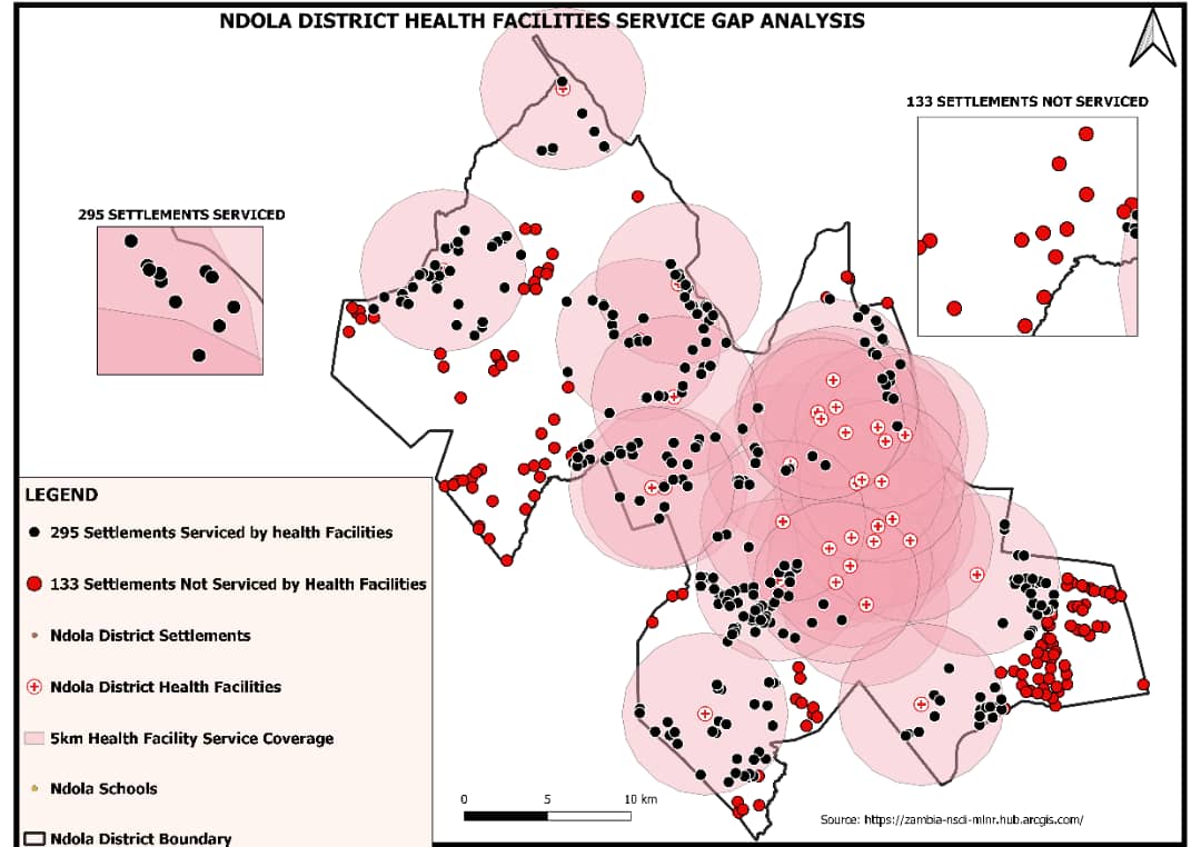
Map from Ndola District
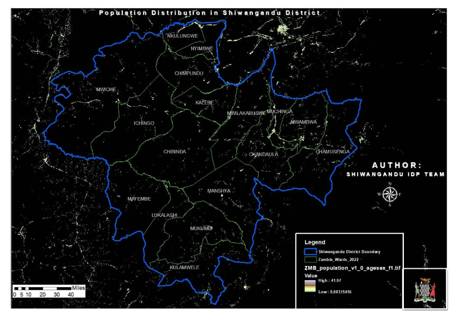
Map from Shiwangandu District
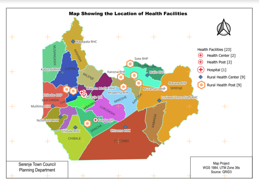
Map from Serenje District
Soft Tembo, Urban and Regional Planner and Town Planner/GIS Officer, Serenje Town Council describes how Serenje District is using its maps:
“To create an integrated development plan, there are three stages involved. We are currently at the baseline stage, which requires an “Issues and Services” report. At the baseline stage, we aim to understand where people and local services are located. Prior to participating in the ToT program, the maps our council had were not accurate. I used GIS techniques and GRID3 data provided through the program to produce/update our maps, which helped us to identify service gaps in Serenje. According to national standards, anyone located within 5km of a health facility or school should be able to access health and education services. In the updated maps, I created service buffers [around schools and health facilities] so that we could easily locate populations where access to these facilities were either high or low.”
The ToT programme in Zambia is part of GRID3’s work to support countries with their spatial data needs and capacities. To date, similar training programmes have also been held in Burkina Faso, the Democratic Republic of the Congo, and Nigeria.
