GRID3 tests semi-automatic mapping of pre-Enumeration Areas to support census cartography in the Democratic Republic of the Congo
The latest population and housing census in the Democratic Republic of the Congo (DRC) dates back to 1984.
A census aspires to count every person in a defined territory at a given time, providing key information on population and socioeconomic factors. Governments use these data for electoral planning, policy decisions and formulation, and the allocation of resources for essential development such as health programmes, schools, roads, and much more. For the DRC, the absence of a recent census means that the country has had to rely on population projections as the basis for decision-making.
A census is among the most complex and massive peacetime exercises a nation undertakes. To support pre-census activities in the country, GRID3 has been working closely with the National Institute of Statistics and the Bureau Central de Recensement (BCR, Census Bureau) to provide overall technical assistance and support to incorporate geospatial data into census planning and cartography implementation.
In preparing for a census, a country needs to be divided into small units which provide manageable areas for census data collection teams to work within. These small units are called enumeration areas (EAs) and may typically contain 150 to 200 households in rural areas, and 200 to 250 households in urban settings. During a census, enumerators are assigned enumeration areas, in which they survey all households and persons.
Satellite imagery and GIS (Geographic Information Systems) techniques are increasingly playing an essential role in census planning. This includes accurate delineation of enumeration areas. Generally, EA boundaries from one census will form the basis for the EAs in the next census, with updates needed to account for new settlements and changes in population density. However, in countries where there hasn’t been a census for many years, often due to conflict or insecurity, EA boundaries can be incomplete, outdated, or missing altogether. Even for countries where national censuses are routinely conducted, updating EAs is a challenging yet essential task in the preparation for a census. Commonly, EA delineation is done during field cartography, often followed by manual digitisation of small geographic units on high-resolution satellite imagery or physically walking along the boundaries of an EA. Both techniques are highly time, cost and labour intensive. At the moment, a recent national, digital EA dataset which can be used for cartography planning does not exist for DRC.
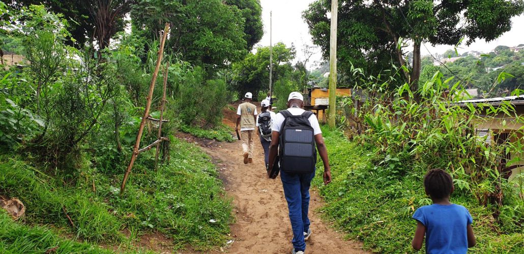
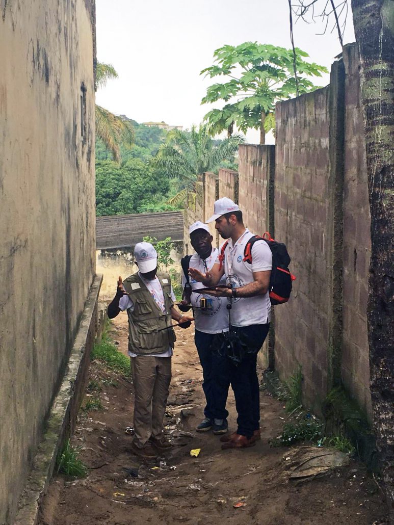
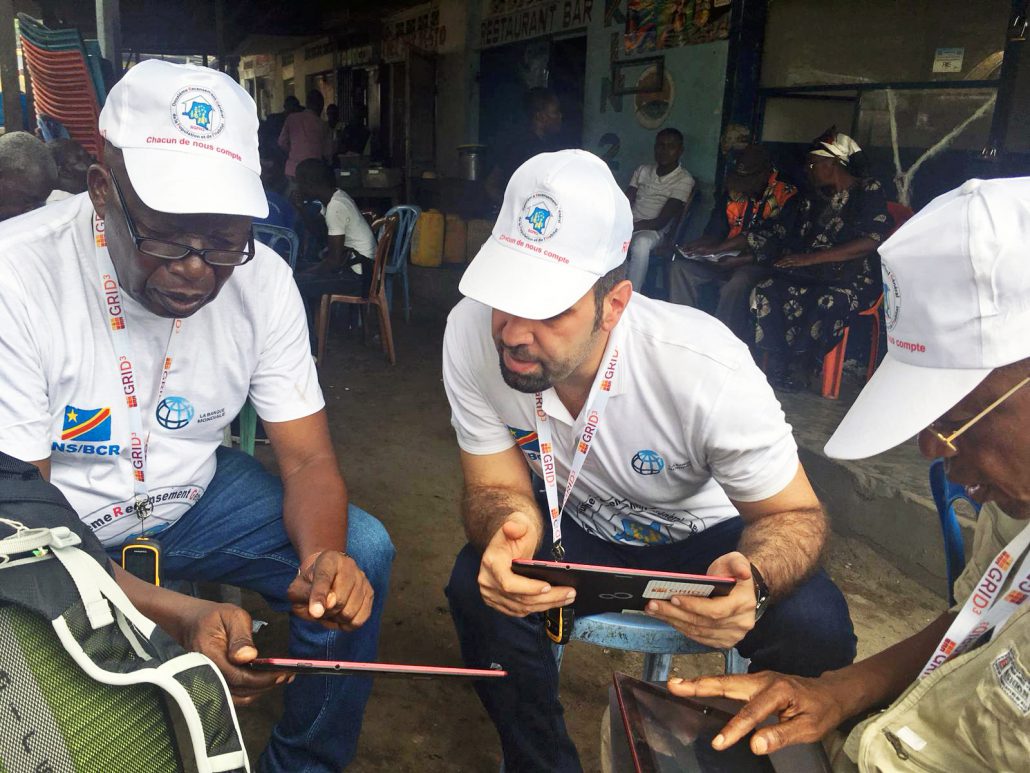
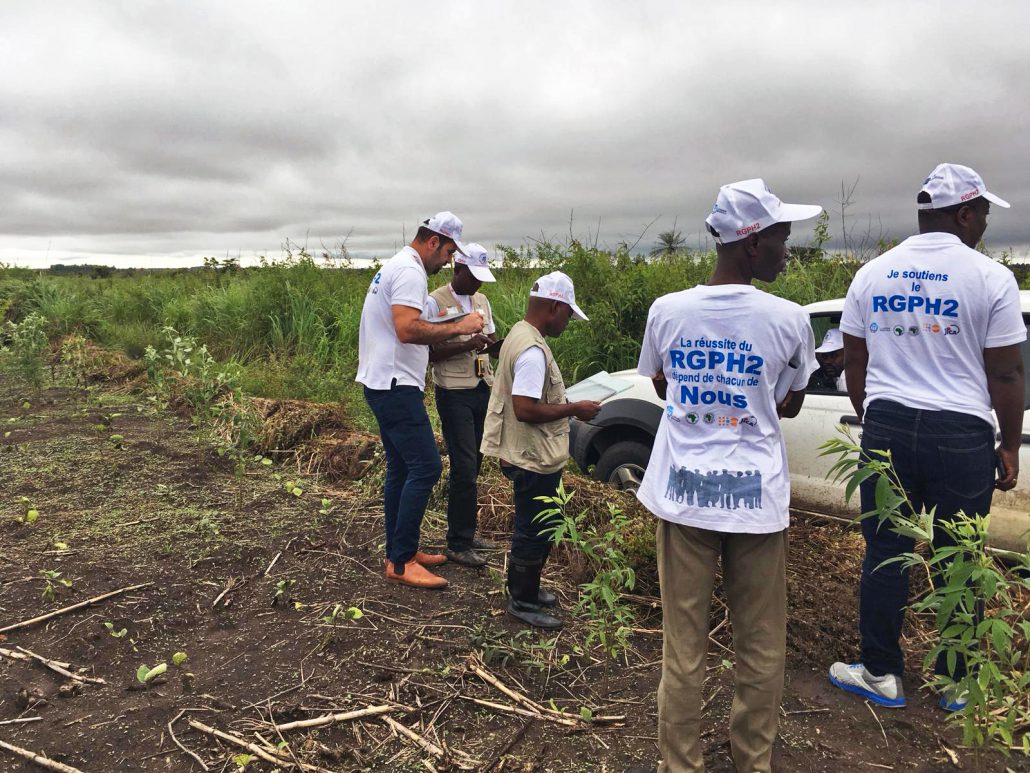
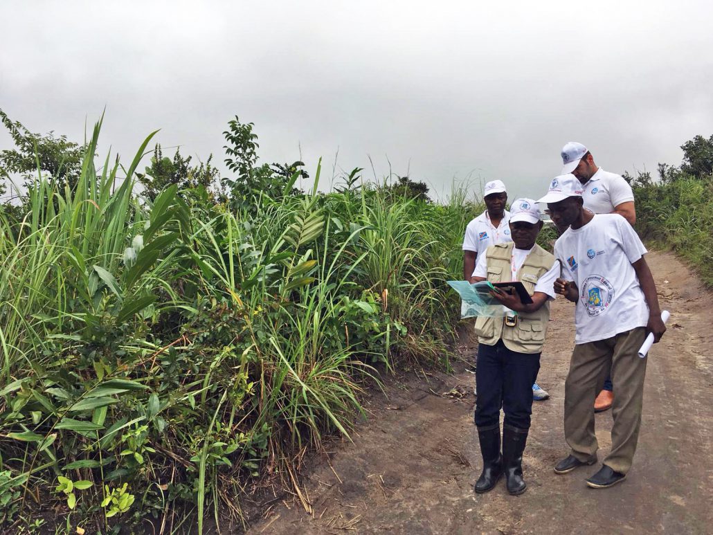
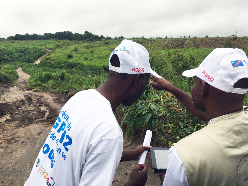
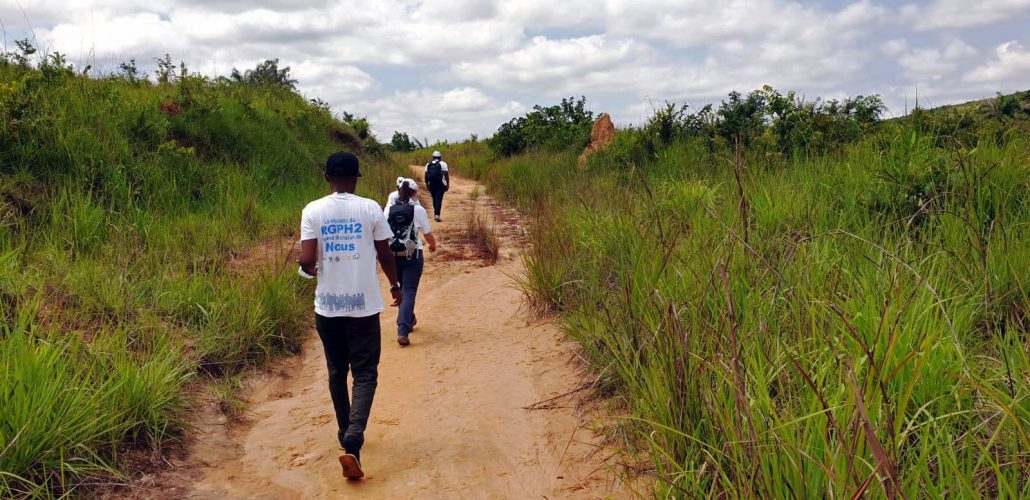
Between 05 and 13 December 2019, the GRID3 team together with in-country partners, carried out a series of field tests in a range of urban and rural contexts to assess the suitability of a semi-automated approach to create pre-EA boundaries. In this context, pre-EAs are approximate enumeration areas that are intended to be checked and validated in the field. The BCR identified three field sites in the provinces of Kongo-Central and Kinshasa. Using the semi-automated approach, GRID3 created approximately 300 pre-EAs across the three sites, which were checked against satellite imagery before fieldwork. Out of these 300+ outputs, 15 pre-EAs were selected for detailed data collection in the field.
This approach, currently under development, utilises the GRID3 high-resolution gridded population estimates, produced for five western provinces (Mai-Ndombe, Kwilu, Kwango, Kinshasa, and Kongo Central) and digitised geographic features, including administrative boundaries, and natural and man-made features, such as rivers and roads. It then divides the regions into small areas which are then merged to meet the criteria specified by the country, including specified population thresholds, alignment with administrative boundaries and respect of physical features (e.g. rivers). The field testing, which was led by DRC’s Census Bureau, the BCR, was intended to provide GRID3 DRC partners with insights into its suitability in relation to the DRC census.
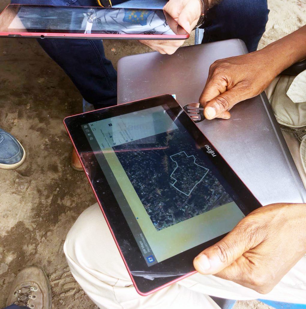
Through these activities, the BCR and the GRID3 teams aimed to assess if the generated pre-EAs met the necessary criteria. In addition, the field tests aimed to evaluate whether the generated boundaries were easily identifiable on the ground. To do so, the BCR teams used tablets with live GPS location shown on satellite imagery with overlaid pre-EA boundaries. This set-up enabled the enumerators to know where they were in relation to the boundaries, and therefore which households they needed to enumerate.
The fieldwork was successfully conducted and expectations were met and even exceeded: the pre-EA outputs were found to help facilitate enumeration, as the BCR teams could navigate within the pre-EA boundaries with ease and count every person within these areas. As the semi-automated approach is under development, GRID3 will further work with in-country partners to evaluate the full findings from the field test and maximise the utility of the approach in preparing for the census, through further testing and ultimately the development of a national pre-EA boundary dataset.
