Naming all settlements in Nigeria: GRID3 and Premise test data collection approaches in Bauchi State
GRID3 Nigeria is collaborating with Premise Data to collect and validate names for newly identified settlements. With access to the latest building footprint data1, GRID3 was able to identify previously unmapped settlements and derive their extents. Settlement extents indicate the spatial area (the coverage) of a settlement and can inform development interventions. For example, analysts can use them to quantify populations within certain areas, or assess distance to key infrastructure such as roads or schools. However, proper local identification often requires referring to certain areas by name, hence the need to label geographic extents with locally validated nomenclature.
To ensure accurate identification, GRID3 partnered with Premise to collect and validate settlement names, improving the existing GRID3 Nigeria settlement dataset. Premise relies on a network of paid contributors to collect data on the ground. Premise contributors are local people trained to take surveys and share local information through the Premise app. All of the data collected through the app is relayed in real-time to their data and analytics platform.
Pilot study: testing data collection methodologies in Bauchi State
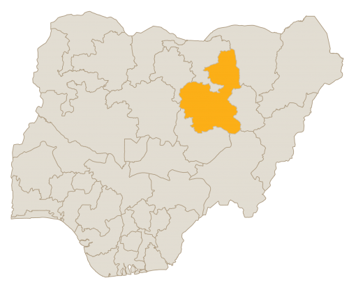
The collaboration started with a two-week pilot study in Bauchi State, testing two different data collection methodologies. The pilot aimed to make comparisons between two main approaches (A and B), as well as to learn about potential deviations influencing the spelling and/or local identification of settlement names, in order to select a preferred methodology that would comply with desired quality standards, before further scale up.
The pilot consisted of 17 settlements, 10 and 7 of which were unnamed and named, respectively. The idea of having contributors collect names for already named settlements was for GRID3 to test and validate the quality of data already collected. In addition, each of the settlements were tested three times, where three different contributors provided data on the primary and alternate names. Sending three contributors to each settlement allows for independent comparison toward validating accuracy of the spatial location and identifying other potential quality issues, which can include inconsistent spellings due to language diversity and oral evolutionary changes, and the inclusion of generic names within the settlement names. While these issues do not have immediate fixes, some measures have been suggested to mitigate them, such as requesting contributors to indicate the village chief’s name as the alternate name of the settlement or by noting the specific language in which the settlement name is written in, if applicable, to help with spelling post-data collection checks.
The team tested two different approaches. For Approach A, Premise and GRID3 did not give contributors any directives for interviewing community members in learning the settlement name. It was up to the contributor to determine the best way to obtain the name. For Approach B, contributors were required to ask a health facility or local shop staff to identify the name of the settlement.
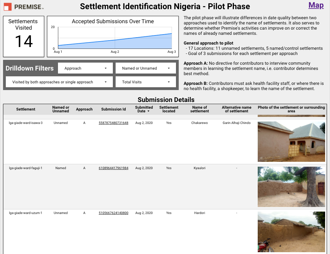
Screenshot of the Premise dashboard presenting an example of three submissions.
For each submission, contributors are asked to specify the approach taken, the name of the settlement, the alternative name of the settlement and a photo of the area.
At the end of the collection period, Premise’s analytics team compared results from approaches A and B. The assumption was for approach B to be of higher quality than approach A, even when approach B could take longer (due to finding the adequate person to ask for a name), and hence to be more expensive than A. However, this assumption did not hold true during the pilot.
“The pilot did not show any significant differences in quality between the two approaches. We also noted that many of the new settlements did not have either a health or a shop facility, resulting in many submissions from Approach B mimicking Approach A in practice” explains Andrew Howe, Program Manager at Premise. Moreover, the three submissions requirement per settlement proved useful for the team when ambiguities in the spelling needed to be resolved.
Expanding data collection across Bauchi State and the whole of Nigeria
As a result of the pilot study, partners agreed to apply Approach A for the remaining data collection efforts across the state, which will be completed by the end of September. While this is no longer a directive for learning settlement names, contributors will also help identify or validate health facilities they may encounter in these settlements.
“Following the pilot study, we have continued our data collection efforts across Bauchi State. With Premise, we asked contributors to follow Approach A, maintaining the three submissions requirement to monitor data quality. Once this work is complete, we will expand into other States to obtain comprehensive settlement data for the whole country,” comments Emilie Schnarr, GRID3 Nigeria project lead.
While GRID3 Nigeria aims to name all settlements across the country, the team will regularly monitor and adapt to the existing mobility restrictions put in place due to the COVID-19 pandemic. Current settlement data, alongside all GRID3 Nigeria datasets can be accessed through the GRID3 Nigeria data portal.
