Getting to know GRID3: Oualid Fouad, GIS Fieldwork Manager, DRC
Over 2026, we’re introducing you to some of the people who make GRID3 the organisation it is. We’re starting with Oualid Fouad, GIS Fieldwork Manager for GRID3’s work in the Democratic Republic of the Congo (DRC). A native of Morocco, Oualid manages our polio work in the DRC and has trained hundreds of people across Francophone sub-Saharan Africa on how to use GIS in development work.
Have you always loved working with maps?
Yes, absolutely. I have always enjoyed exploring the Earth, whether through maps, satellite imagery, or understanding how landscapes and human activities interact spatially. There has always been something fascinating to me about being able to visualize and better understand the world through geographic data.
A formative part of that journey was studying geology at the University of Hassan 2 in Morocco. Pursuing a master’s degree in GIS and Territory Management at Hassan 2 helped turn that interest into a professional path by combining geospatial technologies with real-world planning and development applications.
How did you first become interested in using geospatial data to improve development outcomes?
My interest in geospatial data grew from seeing how much development work depends on knowing not just what is happening, but where it is happening. In health and campaign work, I saw that maps, location data, and field evidence can reveal gaps that would otherwise be missed–underserved communities, inaccurate boundaries, weak vaccination coverage, or teams not reaching the right areas. That made it clear to me that geospatial data is not just technical data; it is a practical tool for better planning, stronger monitoring, and more equitable outcomes.
What in particular attracted you to GRID3?
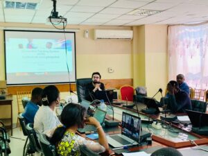
The opportunity to use geospatial data in a way that has a direct operational and human impact. I first joined as a GIS trainer, leading trainings across French-speaking African countries, and that experience showed me how powerful capacity strengthening can be. Supporting local teams, sharing technical skills, and seeing colleagues become more confident in using spatial data for decision-making was extremely motivating to me.
GRID3’s approach–combining technology, field realities, and local capacity building–aligned strongly with what I believe development work should look like. Being able to contribute to strengthening the expertise of fellow African professionals, while helping governments and partners improve planning and service delivery, is what truly drew me to the organization.
What makes GRID3 unique, in your opinion?
Its ability to connect high-level geospatial analysis with very practical field realities. Many organizations produce data, maps, or dashboards, but GRID3 focuses on making that information operational and usable for decision-making on the ground.
Another aspect that stands out is the emphasis on local capacity strengthening. Rather than only delivering technical solutions, GRID3 invests in training and supporting local teams so that countries can progressively own and sustain the work themselves. I also think GRID3 is unique because of how adaptable its tools and methods are, whether for vaccination campaigns, microplanning, settlement mapping, or improving service delivery in hard-to-reach areas.
Do you have a favorite experience working at GRID3?
One of my favorite experiences at GRID3 was the Geospatial Tracking System implementation in the Malemba-Nkulu health zone in the DRC, an area often referred to locally as “l’axe du mal,” or ‘the evil axis’, because of how difficult and hard-to-reach the terrain is.
What made the experience so memorable was the combination of technical, operational, and human challenges. The roads were extremely difficult, access to some localities was complicated, and at one point, I even had to spend the night in the vehicle because reaching the destination safely before dark was not possible. Experiences like that gave a very real perspective on the realities faced by field teams and communities in remote areas.
Despite those conditions, the project showed how geospatial tools and real-time monitoring could directly support vaccination activities and decision-making on the ground. Seeing maps, tracking data, and analysis all translate into practical action in such a challenging environment made the experience especially meaningful to me. It reinforced my belief that geospatial technologies can have a real impact when adapted to field realities.
What lessons have you learned about how to effectively work with stakeholders?
One key lesson I’ve learned is that effective stakeholder engagement is as much about listening and understanding operational realities as it is about providing technical solutions. Each stakeholder group has different priorities, constraints, and levels of familiarity with geospatial tools, so adapting communication to their context is essential.
I’ve also learned the importance of building trust through consistency and clarity, especially in field-based environments where decisions need to be practical and timely. When stakeholders feel that the data reflects their reality and supports their work rather than complicating it, collaboration becomes much more effective and sustainable.
What do you enjoy doing when you aren’t working?
I enjoy simple things like watching TV, spending time with my son, and just being present with family. I also really like traveling, especially to remote places where I can disconnect a bit and connect with nature. Growing up, I used to spend a lot of time playing video games, so that has always been part of my world too.
For Oualid, the work comes back to a simple idea: geospatial data is only as valuable as its impact on the ground. We’re glad to have him on the GRID3 team.